
Visiting R 130 18
This post is part of a bigger trip I made through Scandinavia with focus on Norway.
From island to mountain
I am sure you heard about the Ice Age and that the land was covered with big ice sheets. The last time this happened around 11,000 years ago amongst others in Sweden. I know that this ice formed landscapes. But I thought this was more in the sense of rubbing off some stone here and putting it somewhere else. Well, I found out there is a lot more to this.
The first time I heard about the so called post-glacial rebound was exactly here. The ice was so heavy that it compressed the crust. The crust moved downwards and forced the viscoelastic mantle material to flow away from the loaded region. When the ice melted this process was reversed and the land started to rise again.
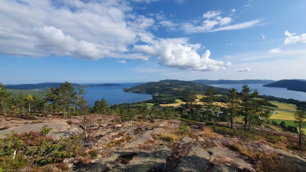
11,000 years ago when the ice was gone the High Coast (ok, not so high then) was covered by the sea and the top of Skuleberget was just a little island in the water. At that time it was just 9 m above the sea level. By today it has risen 286 m, according to the information board at the site this is a world record. It is still rising at a rate of about 8mm a year. This is where the name High Coast comes from.
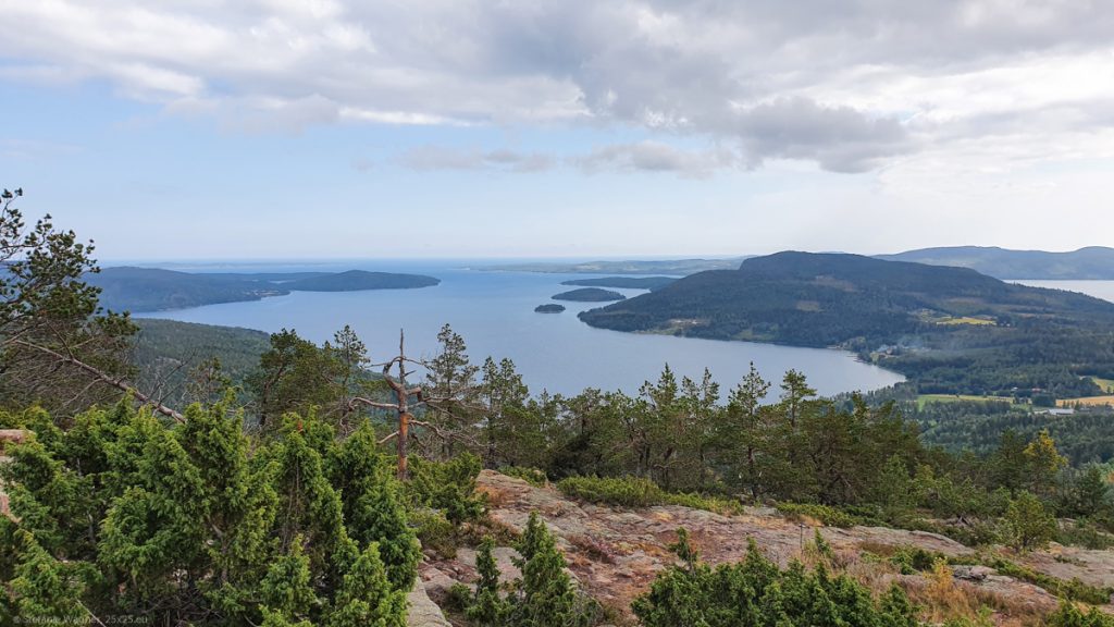
The interesting part is that there is also a difference in vegetation. The top 9 m of the mountain was never covered by water. Anything else was exposed to waves and the sea and therefore as almost no soil. This is why the forestation is thicker at the top and less below the top 9 m.
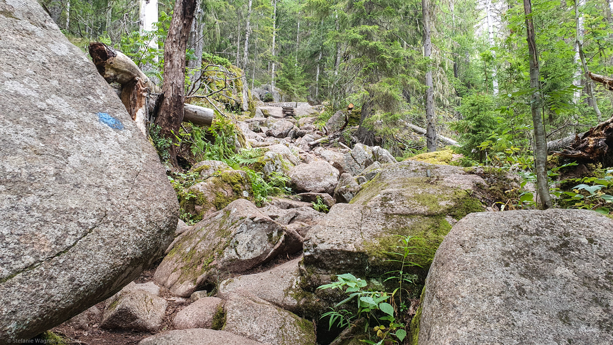
First hike in Sweden
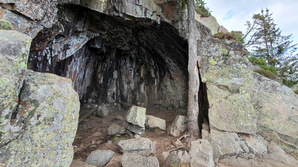
Multiple hiking trails lead to the top. I decided to go for the short (just ~ 1 km) and steep “Grottstigen” first. Its name “Cave path” relates to the cave that is located at around half of the trail. The sign at the bottom said “only with proper shoes” so I went back to get better ones. And I think this was a good decision. In general it seems like Swedish and Norwegian folks are a lot more relaxed when it comes to hiking trails. Here is your dot, go for it.
The cave was most probably formed from erosion by waves from the sea. People used to be here during the Stone Age. Researchers found a lot of flint fragments at the site. But at that time it was just a very small island with nothing much on it. The information board said that most probably they were there just for a temporary visit during seal hunting.
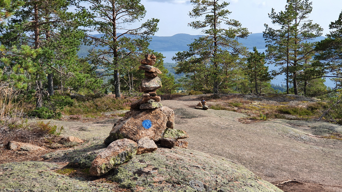
Find the blue dot
When going up the mountain the path was more or less easy to find because you had no other chance, just follow the path in front of you. For the way back I decided to take “Södra Bergstigen”, the Southern Mountain Path. It is around 2.5 km long but gently slopes downwards.
Now here you have a lot more options to walk. Means you go for a small scavenger hunt to find the blue dots along the way. Some of them are pretty obvious, some of them a little more hidden. This was the first time I had to find the path like this. But it definitely wouldn’t be the last time on my trip.
Some travel tips (from 2021)
- There is a big parking lot the Naturum Höga Kusten, you should not have a problem finding a spot.
- If you have a camper van/trailer: you can’t stay overnight at this parking lot but there are camp sites close by. In case you are just passing through there are fresh water and disposal facilities at the parking lot.
- If you have a tent: you can’t pitch your tent at Skuleberget. You need to use one of the camp sites.
- There are different hiking trails along the Skulebergets. When you take Grottstigen have proper shoes, preferably don’t do it when it is wet, and it is definitely easier to go uphill than downhill. Find more info and the map here.
- You can take your dog with you but Grottstigen has metal grid stairs that might not be that much fun for the dog and you will need to carry it there.
